


Yuma 3, Yuma County, Colorado
About
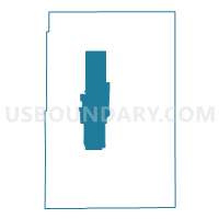
Outline

Summary
| Unique Area Identifier | 549433 |
| Name | Yuma 3 |
| County | Yuma County |
| State | Colorado |
| Area (square miles) | 206.48 |
| Land Area (square miles) | 206.44 |
| Water Area (square miles) | 0.04 |
| % of Land Area | 99.98 |
| % of Water Area | 0.02 |
| Latitude of the Internal Point | 40.03954860 |
| Longtitude of the Internal Point | -102.52010840 |
Maps


Graphs
Select a template below for downloading or customizing gragh for Yuma 3, Yuma County, Colorado


Neighbors
Neighoring Voting District (by Name) Neighboring Voting District on the Map
- Yuma 10, Yuma County, CO
- Yuma 11, Yuma County, CO
- Yuma 12, Yuma County, CO
- Yuma 14, Yuma County, CO
- Yuma 5, Yuma County, CO
- Yuma 6, Yuma County, CO
- Yuma 7, Yuma County, CO
- Yuma 8, Yuma County, CO
- Yuma 9, Yuma County, CO
Top 10 Neighboring County Subdivision (by Population) Neighboring County Subdivision on the Map
Top 10 Neighboring Place (by Population) Neighboring Place on the Map
Top 10 Neighboring Unified School District (by Population) Neighboring Unified School District on the Map
- Yuma School District 1, CO (5,017)
- Wray School District RD-2, CO (3,958)
- Liberty School District J-4, CO (507)
- Idalia School District RJ-3, CO (502)
Top 10 Neighboring State Legislative District Lower Chamber (by Population) Neighboring State Legislative District Lower Chamber on the Map
Top 10 Neighboring State Legislative District Upper Chamber (by Population) Neighboring State Legislative District Upper Chamber on the Map
Top 10 Neighboring 111th Congressional District (by Population) Neighboring 111th Congressional District on the Map
Top 10 Neighboring Census Tract (by Population) Neighboring Census Tract on the Map
Top 10 Neighboring 5-Digit ZIP Code Tabulation Area (by Population) Neighboring 5-Digit ZIP Code Tabulation Area on the Map
- 80759, CO (4,698)
- 80758, CO (3,795)
- 80734, CO (3,045)
- 80727, CO (425)
- 80735, CO (405)
- 80822, CO (260)
- 80755, CO (163)